Ride Report by Dave Thompson:
This was a good ride. Very well organized and supported, there’s little that I could provide in constructive criticism. It was a delight doing a supported 1000…
We started at 4:00 a.m. in Leesburg VA from the Comfort Suites – same start location as the Shenandoah 1200 – and ended that day in Lexington VA at a Best Western. The second day started and ended in Lexington which was convenient for riders and organizers, as we could stay in place, re-use the hotel room etc. The third day saw us back in Leesburg.
A large conference room was setup in the Lexington hotel as the Control. They kept food simple – rice with veggie or meat chilli and chicken soup. Two large rice cookers kept producing rice. Snack food aplenty along with PB&J, breakfast items etc. were continuously available. Soft drinks, juice and beer…
Volunteers staffed the Lexington Control, three for each of the two nights. On the first night you checked in at the Control, got your hotel room key, collected your drop bag, ate and showered in your preferred order, got up the next day, ate again in that conference room and headed out. You were able to leave your stuff in the room as you were coming back to the same place. After the second night you brought your drop-bag back to the conference room.
This ride was organized into three relatively equal days in terms of distance and climbing. The VA countryside in the Appalachians rolls and rolls. There really is no flat. Day 2 featured some longer climbs; the longest being about 1400 feet, but each day came in around 13,000 feet. The cue sheet provided good climbing information, letting you know when we were heading for a “gap” or “crest” and what that climb would be. It also provided Control-to-Control climbing rate, which varied between about 4,000 and 8,000 feet of climbing per 100 miles. For me, the really useful part was knowing the elevation at the gap. Most of those longer climbs are long switch-backs, so it helps to know where you are.
The cue sheet was superb. It had every detail imaginable about facilities on the route, even down to ORF’s (outdoor restroom facilities, aka johnny-on-the-spot). Usually that kind of detail is too much, but not in this case. There were many, many Controls but most were Info Controls, which eased time constraints for the riders. Crista noted the “if this were a timed Control open/close” on the cue sheet so you knew if you were on track. On Day 2, for example, there was only one Control during the day that wasn’t an Info Control, which was about half way through the day. Most of those Info Controls were actually establishments that could have provided stamps or signatures, but were not used that way.
The roads are excellent. I can only remember one significant but short rough patch and it was well noted on the cue sheet. There were no gravel stretches, no fresh chip-seal. We crossed railroad tracks often and many were marked as very rough — but compared to what we experience in Ontario rides, they were a dream. It certainly helps that they get neither deep frost nor Florida heat!
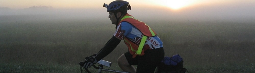
The scenery is pretty, rolling countryside, farms, heavily treed in places but obviously no snow-capped peaks or ocean views. There are rivers and a few lakes but not the 50% water experience of Northern Ontario. Dawn on Day 2 found me at the top of the highest crest looking down at all these hills, orange in the sky, fog filling the lowest points — that was probably the highlight scenery-wise. It’s a great area for cycling, great exercise with all the hills and reasonable traffic.
Everyone can experience something different on these rides, depending on where you are in the group. It was very hot on day one, temps and humidity around 90 – that, everyone felt. I got caught in a short downpour that day; some others didn’t see rain. On day two and three the temperature was gradually easing … some got caught in rain on day two, I did not. We did have wind soon after dawn for a few hours on day three, but that would depend on where you were at that point in time. It did not get cold at night, that’s one advantage of Fall in Virginia. For the most part arm-warmers did the job — highly unusual for me. I carried my heavy jacket in my pack, knowing that sometime a short thunderstorm can produce hail … that was unnecessary, thankfully. I did don the jacket during the rain; was thankful for its protection.
Inevitably I compare this ride to the Shenandoah 1200, since it covers some of the same territory. The amount of total climbing per mile is less, but not much less. The Shen has some long relatively flat stretches … which means that it also has some long, long climbs with steep grades. The Shen covers more north-to-south territory, from Gettysburg PA to Mt Airy SC; the AA is more compact. The days are shorter time-wise on the AA but about the same distance, except for, of course, the last 200k of the Shen as it’s a 1200 vs. the AA 1000.
As is typical on these rides, I’m the Lantern Rouge early on. In this case I was riding by myself and trailing the pack after about 12 miles. By the end of the first day I was somewhere in the middle of the group of 30-some riders. There were a couple of riders who rode through, but most got some sleep. The fast getting-some-sleep group of six riders finished the ride about 10 minutes ahead of me. It was kind of a running joke — I’d come into a Control and find them there; I’d leave first; they’d pass me down the road. I wrapped up the ride at 7:28 p.m. on Sunday for a time of 63:28 against the time limit of 75 hours. When I left the hotel at 3:30 the next a.m. to head back to Reading PA and our youngest son’s family, one rider had just come in and there were still four on the course due in shortly.
I finished Day 1 around 9 p.m.; Day 2 around 7 p.m. I started Day 2 at 1:15 a.m. and Day 3 at 12:45 a.m. That’s actually more night stop time than I usually have on these rides — 4 hours the first night and 6 hours the second night.
Night riding was particularly slow on the second night. My Garmin had frozen at about 280 miles and even when I got it “thawed”, it wouldn’t show the course beyond that point. I ended up using it simply as a cycle computer with a built-in map. That meant a lot of in-the-dark navigating and this route has lots of turns. I stopped a lot. I put in some bonus miles. Oh well. Even though I’ve used the Garmin for many 1200 km rides with the entire ride loaded up as one tcx track, the roads were too winding and therefore the number of bread-crumbs in the tcx over-ran its capacity — that’s my assumption. I should have broken the ride up into separate days. I will do some research on that.
This is a ride well worth doing, but don’t I say that about every ride?