I have never done this 400 km brevet and am so glad that I finally gave it a try this past weekend. It was great, but how could it not be great when we had perfect sunshine all day and a beautiful full moon in the night! Yes, there was the headwind in the morning as we headed to Alliston and the hills between Midland and Midhurst, but these were manageable.
Seven riders started this ride in Concord: Jerzy, Bob and Jean (they are like one person), Brian A, Paul, Guy and I. Significant NW winds were forecast for the day and we met these winds on the journey north to Alliston. The group quickly fractured as it often does with Guy taking a wrong right turn up Weston Rd. and travelling his own brevet route past the first control. We met him later enroute to Wasaga Beach. He announced that due to a 60 km detour and an extra 6 km to get back on route, he was disqualifying himself from the ride and just going to enjoy the rest of the ride and day. Jerzy, Guy and I cycled together to Wasaga Beach and found a hamburger kiosk right on the beach where we sat and enjoyed the view, the whitecaps on the bay, the millions of fun seekers on the beach and in the water, the view of Blue Mountains to the left and the windy experience. I was practically wearing my hamburger on my face because of the wind! We left Guy at Wasaga to enjoy the day and carried on along Tiny Beaches Rd hugging the Georgian Bay coastline meandering along and away from and back to the beach, through beautiful and shaded Awenda Provincial Park, the Kettle Lake beaches and SW on Champlain Rd following the Georgian Bay coastline to Penetanguishene Harbour. Beyond the harbour you get the first view of St. Ann’s Catholic Church, a huge church also known as the “Cathedral of the North”. Champlain Trail carries on to Midland where there is another huge cathedral called “The Martyrs’ Shrine”. Here’s what I learned five minutes ago about the Shrine:
About the Martyrs’ Shrine
The Martyrs’ Shrine is the National Shrine to the Canadian Martyrs. The Shrine honours the eight Jesuit Saints who lived, worked, and died here over 350 years ago, celebrating the significant contributions they made to the introduction of Christianity into aboriginal culture as well as the founding of the Province of Ontario and the nation of Canada.
This historic and holy site includes the famous Shrine Church, the Martyrs’ Hall and Education Centre, and 75 pleasantly landscaped acres which invite you into prayer and tranquility. Within the Church are the relics of the Martyrs St. Jean de Brébeuf, St. Gabriel Lalemant, and St. Charles Garnier, while the grounds are home to beautiful walkways, monuments, and altars.
After all these beautiful beaches and sightseeing the hills began on Horseshoe Valley Rd, 680 metres of climbing to Midhurst. The next stage of this ride is through picturesque Simcoe County, home to idyllic farms and gorgeous sunsets, all pink and gold across the sky. The last stretch of the ride from Bradford is through the Holland Marsh but it was dark and not much to see but the beautiful full moon. The Canal Rd is bumpy and potholed and one has to focus with an eagle’s eye while pedalling along these gravel roads before crossing Highway 9 to Weston Rd and back to Concord for a 3 am finish. Brian (12:23) and Bob/Jean (12:51) had slipped their cards through the window of my car. Paul and Guy’s cars were not in the parking lot; one person retiring early from the ride, the other gone home after enjoying a day at Wasaga Beach. A special thanks to Jerzy for his support and camaraderie on this ride. I got a great workout yesterday chasing him on the flats and up the hills for 400 km. He would have finished faster if he hadn’t slowed down many times at the tops of hills to wait for me come chugging along. What a great route! Every randonneur must do this ride at least once, it’s worth the challenges.
Warning – be careful what you say to Liz Overduin, she takes your comments seriously. I apparently said to Liz last year that a flat ride is boring so she set out to create a ride that was not flat and far from boring!!
Congratulations to Liz for working so hard to create such an amazing new Huron chapter 600 km route. The route has everything for the intrepid randonneur including picturesque Grey county farms, very challenging hill climbs, thrilling descents, stunning Beaver Valley scenery, gorgeous beach views along Lake Huron and a road tour of the Bruce Nuclear Power Plant. Liz’s route winds and zig zags up and down on the first day (and I mean up and down, think Bowles Hill, Scenic Caves Rd, County Road 40 all in one afternoon!) and in and out on the second day, from the road and all along the Lake Huron shoreline from Sauble Beach to Kincardine. On this super hot inaugural ride, we were blessed with no wind, no rain, and two beautiful summer days. And, we were treated to classic Huron chapter camaraderie including some good eating and drinking in Goderich, Sauble and Kincardine, free drafting, and the classic Huron Chapter Hug at the end of the ride: sweaty, sincere and very pleasant! Thanks to Liz and the Huron Boys: Dick, Carrey and Larry, and to Henk, Fred, Guy, Alex and Vaune for a great rando ride weekend. Fred had a challenging time slaying the Scenic Caves dragon, Vaune fought some intense nutrition and health battles but managed nevertheless to dig deep and complete the ride because she is one tough lady and Alex Weber never stops smiling and singing, perhaps because he finished his first series and is now a super randonneur!
Yeah Liz! I am already looking forward to doing it again next year! Wait a second, did I just say I was looking forward to those gruelling hill climbs again….that folks is a classic symptom of what we call “randonesia”, a term involving memory loss and the inability to recall periods of intense pain experienced on a ride.
Comments from Liz Overduin:
Thanks Kathy, and I also loved riding it with everyone who came out. Last year, when I was plotting and planning it, by the second day, thanks to a headwind from the south, I actually had my first ever Bonk. This time it was a great experience, the weather was great and two cyclists completed their Super Randonneur Series – Larry Sowerby and Alex Weber – a Rookie!
Three of the ten cyclists were women – 30% is pretty high in this sport, and that was very enjoyable. Vaune has speakers on her bike and we could listen to her music. A common question to ask folks is “What kind of music do you like to listen to?” The answer is usually something straight forward and simple, “country”, “jazz” or “rock ‘n roll” etc. Vaune’s answer was a classic. Vaune said, and I quote “I like to listen to 85 or 95 cadence music, all my music is at that cadence”! Seriously, that is what she said! I love it Vaune!
Kathy was amazingly strong on her bike, you would never know that this was her first brevet after 6 weeks of recovering from a broken arm – it was so great that you could do this ride Kathy and I am glad you enjoyed it.
The Huron Chapter has enjoyed sharing so many of our rides this summer what with Devil Week as well as this Brouse’s Beach Browser – 60% of the cyclists were not from the Huron Chapter – it was great to have you.
And, just for one last statistic, Larry Sowerby and I are both from Auburn, a town of maybe 100 people, and two of us are Randonneurs! We’re taking over – watch out World – the Randonneurs are coming!
Comments from Vaune Davis:
It was great riding with the hybrid Huron/Toronto group… and also with a trio of gals. I struggled quite a bit on this ride so ended up on my own, which did not bother me. I was super tired going into this and my pace collapsed. But the beauty of this unique route was not lost on me, so I managed to enjoy it even in an exhausted state and complete my Super Randonneur series. Hats off to our expert route chef, Liz Overduin. We are blessed to have you in our club. That route was a lot of work to plan. I’d like to do it again next year in a more rested state.
The stereo speakers on my bike worked beautifully. They are a brand called “XCEON” that strap to the handlebars and can be recharged from the dynamo hub. I bought them at the bike show last fall. One impulse buy I do not regret.
Congratulations to our rookie Alex for completing his first SR series, and with a smile on his face. Alex that is a significant accomplishment. You should be very proud.
“Monsieur” a short pause, then louder “Monsieur” and then much louder “MONSIEUR” a flag man is trying to address David McCaw who has stopped his bike just in front of me at a line of 5 men who stand in the twilight at the south end of the town of Lac Mégantic Quebec. I say something in English and one of the flag men steps forward and asserts with very precise English, “You cannot go there”. Two tired randonneurs meet 5 very tired firemen at the south side of Lac Mégantic Quebec on the evening of July 6, 2013. Our route is to the left into downtown on Rue Laval. Our ride has brought us 325 km from Montreal. The GPS shows only 2.4 km to the control in Tim Hortons, food and rest. All we see to the left is dark and shadows. The evening sky is black with smoke. The street is blocked by a huge stainless steel tank truck. A fire hose snakes up the street. A Surette du Quebec police car tweeted its siren to attract the attention of the flag men as it crawled out of the darkness. At the sound, the men’s heads snap to look over their shoulders. They stared up the street into the dark as 2 randonneurs coasted in front of them and stopped. We stared also. David later said that he was thinking “There is so much smoke this whole town must be on fire”.
“What is happening?” I asked. The young man has a most precise answer. “Since 1 o’clock this morning, a train of 73 tank cars carrying fuel has derailed in Lac Mégantic and is burning. All of the houses in downtown Lac Mégantic are destroyed.” “What kind of fuel?” I ask as if it mattered. “I do not know. Maybe kerosene” and he wrinkled his nose.
“You cannot go this way” he asserted again. “We want to go to Lennoxville” I say. He stared at me. That is clearly beyond the scope that we can discuss. Lennoxville is 92 km to the west. I asked, “Is there a way to go north on Route 161?” “Yes. You must go this way” pointing to the east under a railroad trestle. “There will be a way to go north that way. Someone will help you.”
We turned right and made our way under the railway where there was a street light and continued on into darkness. Cars milled about on the few small streets. All moving slowly as their drivers navigated unfamiliar and little used streets. They were moving in a particular direction and we followed. It was now complete darkness and we stopped after maybe 1 km to look at the GPS screens. A car passing on the other side of the road stopped and a young man got out to offer us assistance. When he heard that we were randonneurs on an official brevet, he was not only impressed but had heard of randonneuring. I only remember him as a young man wearing a red tee shirt. From him we learned that the Tim Hortons had survived and was open. We also learned that the route around the fire was on a new bypass road. If we followed on to the east we would find the bypass. Then going north there would be a roundabout and an Ultramar station where we could return to highway 161.
We continued to the east over a rough street and a climb and arrived at a T junction with a 4 lane road. We turned left onto the wide road through slow moving traffic. I was happy that on the far side of the road my Edelux showed a wide paved shoulder. We rode north on the bypass through dark forest. My GPS showed that we were moving parallel with the brevet route. When we passed an intersection with some cars coming out of town I realized that we were past the fire zone. I called to David to stop for another GPS conference. As we studied our screens on the shoulder, a largish truck of some kind fixed us in its headlights and slowly rolled to stop. A man appeared from around the blinding lights asking “Je vu prendre la route a St George. Est-ce que c’est la?”, pointing up the road. “Parel anglais?” I ask. “Non”. After a few seconds, I say “Je ne sais pas” my most accurate statement of the night. He gave a sad smile, shrugged in resignation and returned to his truck and slowly continued his drive.
We returned to Lac Mégantic along with the local traffic using little travelled side streets. As everywhere that night, it seemed that the climbing was hard on steep hills on minor streets. There was a continual haze of car headlights as people milled about constantly.
The guess was good. We returned just on the north side of the evacuation zone. As we reached downtown, the area to the south was black with shadowy figures of firemen, police and paramedics moving about in the disaster zone. On the other side, the street was a blaze of light. The Tim Hortons was only a few hundred meters away. Across from the Tim’s a McDonalds golden arch blazed. We cautiously made our left turn into Tim Hortons and found a free table on the patio. Although randonneurs are focused on the ride and I have to be to keep on going, some of what I felt that night seeped in and is still slowly percolating up in my consciousness on Monday. The Tim Hortons was very busy. It seemed to be full of families with babies in carriages, children, and a few older people. Several families stood in clusters surrounding other families seated at tables, all talking quietly. Policemen, police women, paramedics were coming and going. The drive through speaker was nearby and there were frequent orders like “Un cafe grand avec une creme et deux sucres” sounding. Staff who were too tired to respond to our English waved us over to a server who spoke English. I was too tired to struggle with French. The server warned “We are running out of some things, it has been hectic”, but we got our stuff.
The brevet had started at 5:00AM at St. Lambert on the south shore in Montréal with 8 riders. The route name is just “The 600” from Club Vélo Randonneurs de Montréal but since Lac Mégantic is the turnaround point I like it better. The four fast guys were out of sight before we got off the streets of Montréal, but 4 of us Marc, Yves, David and me stayed together to St Césaire, the first control at 55 km. Marc had a flat as we left and David and I rode on. Marc and Yves were riding their first 600 and had a plan of stopping every 50 km for water and supplies. David and I carried Camelbacks and planned on 90 km stops. The 2 pairs rode at about the same average speed but gradually separated, seeing each other at controls. David and I were just leaving Cookshire 233 km as Marc and Yves arrived. They successfully found their way around the evacuation zone and were south bound to the Tim Horton’s control when we passed in the night. David and I were north bound going uphill to Nantes and just saw the lights of the 2 randonneurs passing on the opposite side of Route 161.
The focus on “keep going forward” is strong. Maybe too strong sometimes to forewarn of what we were riding into. As we had approached the town from the south, a strange cloud had been visible. The sun was low over the hills across the lake. A steady west wind blew and from 15 km away strange black clouds could be seen scudding low across the horizon. Fog off the lake I thought at first, but there was no cloud over the lake. The black clouds seemed to originate where the town should be and I filed in my brain the possibility that there was a fire in or around the town of Lac Mégantic. We were recovering from an afternoon of searing heat and tough climbing on “La route des Sommets” crossing Appalachia Quebec as signs indicated. In the evening, the temperature was dropping, the road was flat and we rolled.
At the first “Route barré” point about 10 km south of town, cars seemed to be entering the closed section of the road as well as taking the turn. I asked the first Transport Quebec employee “Peu passer?” and he said “Passe” and waved me on towards town. The second Route barré was the same. A Transport Quebec employee with a flag waved us on. In the calm light provided by Google maps on Monday the cause of the ambiguity becomes evident. The town of Lac Mégantic is naturally divided by the Chaudière River. Many people live south of the river along the beautiful lakeshore. There are no stores or services south of the river. Those are downtown north of the Chaudière and another collection of stores along a highway strip that leads in from the north. A bridge on the Chaudière connects the main street with south. We were stopped at the south end of the bridge. When the explosion and fire destroyed downtown it cut the town in half and reduced the services to those available from the strip of stores along the northern part of Route 161. The next bridge is about 4 km away on the new bypass which cuts through the forest east of town and was not in my GPS map. Emergency responders had to deal with people from the south getting to services only available north of the evacuation zone. Evacuees from either direction were going around the zone to get to relatives in whatever direction needed. Emergency personnel were securing the evacuation zone perimeter, but could not provide travel plans for the thousands of people involved locally, let alone the few randonneurs trying to transit through the town. We only did maybe 6~8 bonus km to get around the zone but used at least 1 hour.
Traffic leaving Lac Mégantic was not heavy, but produced some memories. An inbound train of Surette du Quebec cars tunneled out of the dark, sirens howling lights blazing. Maybe 10 cars rocketing toward town. Although noisy and bright they were traveling so fast that even the sound vanished in seconds. In contrast, the north bound traffic seemed to lumber. A high wall of a big ambulance slowly crawled past my shoulder. Then a much higher wall with loud diesel noises crawled by. Incendies – secours showing on its back from the light of my headlamp. The out bound machines crawled, no flashing lights. At the intersection with Route 214 we turned left and entered a different place. Stars filled the sky. The west wind cooled our bodies and brought fresh smelling, lower humidity air for our lungs. The pavement was smooth and almost empty of traffic. Our route through a silent forest had more descent than climbing. It should have been an ideal night ride but the scenes of exhaustion and chaos that we had witnessed lingered. Not to mention my own exhaustion after a day of climbing in hot weather followed by confusion and delay. We reached Lennoxville at 3:28 and were asleep at the hotel before 4:00
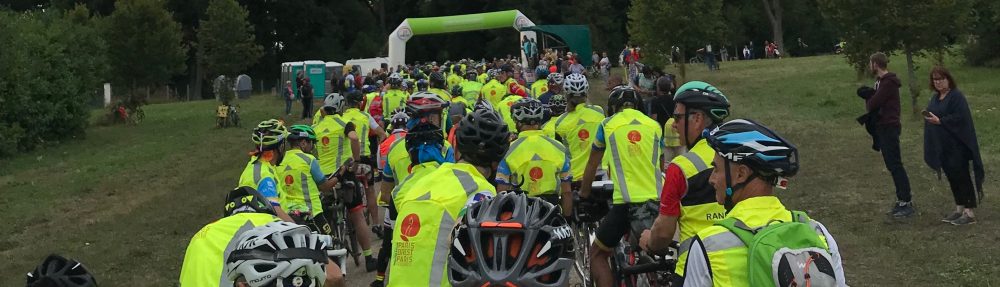
We had a good-sized group of twelve riders for the Lake Ontario 1000, despite the less than perfect forecast. Renato, Henk, Jerzy, Dick, Bob K., Albert, Fred, Jean, Terry, Brian and yours truly all headed out at the very democratically decided 6:00 start time. Stan rounded out the twelve on his new bike, a steel Marinoni Sportivo. A few of the more disciplined riders settled quickly into their own paces, but the majority stayed together for the first stretch of the ride to Hamilton and the climb up the Escarpment. This was enough to pull the group apart, at least for a while.
Albert, Renato and I formed a new group at the front riding along Ridge Road and some great scenery. Thanks to David T. for suggesting the route modification to get us off the service roads along the QEW. Renato missed a turn on a descent, putting Albert and I off the front. Renato seemed to recover quickly, and I saw him come back onto the route, but we went around another curve and lost sight of him. Around the 80 km mark, Albert and I stopped for food and water. We came out of the store just in time to see the main group zip past us. Getting back on out bikes, we caught the group, and found no Renato. He had simply disappeared.
Albert and I pulled away from the group again going through St. Catharines. I assume they stopped for supplies. Albert and I pressed on through Niagara on the Lake and back up the Escarpment. This has to be one of the most scenic stretches of road in Ontario. We got to the border crossing to find traffic backed up into the access roads leading to the bridge. We used our commuting skills to move through the line, where a helpful agent directed us to the Nexus Pass lane. The border guard processed out passports and handed them back without a single question, which was a new experience for me. Normally, my name generates a small book of wanted felons and I have to play twenty questions while we establish that I am not the fellow who held up a liquor store last fall in Portland.
Since the border crossing was so busy, we did not bother them with the control cards, instead stopping at a fast-food kiosk where they filled our bottles and fed us BLTs and Cokes. For some reason, the restroom was marked “out of order”, but proved to be perfectly serviceable. I am continually amused at the reactions we get when we explain what the little control card is for. The evidence that we are in earnest is right there in their hands as they sign our cards, but they still cannot quite believe anyone would willingly do such a thing. Nobody managed to catch us during our brief stop, and we continued on our way.
The next control, Olcott, doesn’t have much on the main road. I think I need to amend the route to include turning towards the lake, as apparently, that’s where everything is. Albert and I stopped at a pick-your-own cherry place. The only food they had was cherries (go figure) and apricots. They also had unsweetened cherry juice. The young lady took my bottle into the back and returned with them full of cherry juice and ice. It was a very nice change from water and the regular sports drinks.
Shortly after Olcott, we arrived at the Lake Ontario Parkway, which is the strangest road I’ve ever ridden on. This includes the single-lane bridges on highways in New Zealand, and hurricane-damaged roads in Cuba. The Parkway, for those who don’t know it, is a divided highway similar to the 401. Two lanes in each direction. The difference is, there are almost no vehicles. It was like we rode onto some sort of post-apocalyptic movie set. Traffic did start to increase towards the east end, and we started riding on the shoulder instead of taking the lane, but I’ve been on concession roads with more traffic.
We stopped fairly soon after getting off the parkway for resupply. I ordered a “medium” sub while Albert used the facilities. When he got back, he thought it looked good, so he ordered two larges. They were so big, you probably could have cut one up to feed the entire group. He wound up strapping them to the outside of his bag since they wouldn’t fit inside. While we were dealing with food, the group passed us again, intent on getting to the control before stopping. The place where Albert and I stopped wasn’t actually in Charlotte, so we stopped a fellow who was out for a walk to get our cards signed, with the usual explanations. He was impressed and said our ride put his fourteen miles a day of walking (that he does as part of recovering from knee surgery) to shame. I think he may have that backwards. I can imagine walking fourteen miles, and I certainly wouldn’t want to do it.
We found the group that had passed us had split up. Bob, Jean, and Brian had pressed on while Renato, Henk, Fred, and Jerzy were ensconced on the patio of a pub. After working our way through the lights and traffic of Rochester, we found the leaders just getting ready to leave the control in Webster. The desk clerk, having been through the explanations about the cards already, signed ours and the five of us left together. Albert and I were still riding at a slightly faster pace and left the other three behind.
As we worked along, the terrain became distinctly hillier, and night started to fall. We knew we had to stop before the control in Oswego. Since I didn’t know the route well, I started watching for open signs, finally finding one at an American Legion. The only people in the bar were the barkeeps unwinding after a long day. Despite us not being members, they had no problem filling our bottles for us and selling us a couple of cans of pop. I adhered to my personal adage of never passing up the opportunity to use a flush toilet while Albert went out to his bike for a snack. While I was doing that, I couldn’t help but overhear the Legion members carrying on the standard discussion of our mental health. Albert and I hopped on our bikes and headed out, just in time to see the headlights of the three trailing riders coming towards us.
Oswego was Albert’s planned overnight stop. Before he headed off to his hotel, we went into a Dunkin’ Donuts that was air conditioned to within an inch of your life. I was fine, temperature-wise up to this point, but the AC put me over the edge. I fuelled up, including a large coffee, for the overnight effort, while Albert did some pre-sleep snacking. Just before he headed off to sleep, Brian, Bob, and Jean arrived. I figured having company overnight would be wise, so I waited for them to get food and water. Not a long wait, since they are all well organized and pretty quick at controls.
Fortunately, the terrain flattens out east of Oswego. We rode as a loose group, startling the occasional deer. Jean was starting to feel the effects of lack of sleep and wanted an opportunity to nap. (To be honest, we all did, we just weren’t saying.) We spotted a closed bar with picnic tables outside under an awning, so we pulled in. Jean set his alarm for thirty minutes, and we each grabbed a bench. Other than the mosquitoes finding us, it was pretty comfortable.
Shortly after our nap, as the sun was coming up, then rain started. It didn’t rain very hard, or for too long, but it was enough to send us digging through bags for jackets and saddle covers. At some point through here, Brian and I gradually pulled ahead of Bob and Jean, arriving ahead of them at the next control. They passed us as we ate breakfast, then we passed them on the way to the border. The last we saw of them was in Gananoque. They were pulling in just as we were leaving.
The border crossing back into Canada was pretty uneventful, other than the bridges. Holy smokes, the bridges. Dave T. gave an inkling of what was in store before the ride, but the reality was something else. The signs say to walk your bike, but there isn’t enough room, especially with a pannier bag. So, Brian and I rode our bikes for the most part, at some points with one hand on the handlebars, and one hand on the guard rail. The bridges arch, and the climb up the arch isn’t too bad, but the descent, riding the brakes along the narrow walkway was pretty nerve racking. We did stop at one point to enjoy the view and take some pictures. It was an adventure, and I was glad when it was over. I’ll probably also being looking forward to it the next time I do this ride.
After the crossing, things start to blur a bit. Kingston was nice, but some of the really scenic stuff is beside a descent in traffic, so it went by in a bit of a blur. The convenience store in Bath was very busy, since they also have beer and an LCBO. The line for the ferry must have stretched for the better part of a mile. Again, the bikes gave us front of the line service. I don’t feel any guilt, since the bikes don’t displace any cars from the ferry, and it made no difference to those we passed.
The ride through Prince Edward County went faster than the last time I did it on TOT in 2011. During TOT, I had to beg for water from a couple out in their yard barbequing. This year, no problems, other than a flat just outside Brighton. Since the puncture was from a roofing nail, finding the source of the flat was easy and a tube change was quickly done. Brian didn’t even have time for a nap, but we were there long enough for a passing car to stop and offer assistance. Back on the bikes, and we were off to the control at Brighton and onto the Waterfront Trail.
The sun set on us again as we made our way through the lake shore towns. People are partly solar powered, and with the darkness all the effects of the lack of sleep come crashing in. By this point, I was not particularly comfortable. My hands hurt and a saddle sore that hadn’t completely healed from the previous weekend was making me regret ever discovering the concept of sitting. My feet were aching and felt like all the joints had seized up and needed to be popped loose. I didn’t so much want to take my shoes off as simply remove my feet. On top of this, my brain was starting to feel the effects as well. Company helps, but it still gets weird on the second night. I seem to have a tendency to anthropomorphize everything I’m thinking about. So, instead of thinking about the next place for water, I have an imaginary conversation about it. Like I said, weird.
Brian was also starting to suffer, with his IT band acting up on him. It got to the point where we were pulled off in a parking lot at Taunton and Enfield and he lay down while I stood on his buttocks with my heel. Yet again, a passing car stopped to ask if we were OK. For once, we didn’t have to explain what we were doing on our bikes in the middle of the night. The driver asked, “Are you randonneurs?” like he encounters people on brevets on a regular basis. It turns out that he knows Renato.
After the long, flat stretches around the lake, heading into the Moraine was a bit of a shock to the system, offset by the fact that Brian and I both know these roads well since we live in the area. I raced ahead to find a toilet at the next control, which turned into the “Quest for toilets”. I finally found one at the third place I stopped, further and further off the route and adding to my collection of bonus miles.
From Stouffville, it’s into the home stretch. The sound of the birds waking up for our second sunrise was very welcome. The last 30 km are supposed to be downhill and the last time I was through here, it was easy to maintain over 30 km/h. Brian and I managed about 25, and were happy with that. We pulled into Tim’s too tired to really show how thrilled we were with our finish. We had a quick bite to eat, and went to our vehicles to nap before the drive home. Even with the nap, I didn’t make it home and had to pull over for another nap, which lead me to having to explain randonneuring to an OPP officer.
So, a long ride report for a long ride, and written in much the same style as it was ridden, in sort of one big rush. I think the randonnesia will take a little longer to set in with this one, but even so I’m very happy with the ride and am looking forward to the Granite Anvil.
I am remiss in not putting out a ride report on the Shenandoah sooner, but time slipped by and so I thought that perhaps comparing and contrasting the two rides might be useful for anyone thinking of doing one or both of these rides.
Timing — Both were held in June of this year — June 6-9 for the Shen and 24-27 for the Gold Rush. The Shenandoah was being run for the 6th time, 6 years in a row and the Gold Rush for the 4th time, on an every-four-year cycle.
Route — The Shen starts out from Leesburg VA, heads north to Gettysburgh PA then south to Mt. Airy NC and back north to Leesburg. The GRR starts in Davis CA, just west of Sacremento and heads north to the Oregon border and then back to Davis. The Shenandoah covers the same roads for a small part of its route; The Gold Rush is mostly out-and-back on the same roads.
Climbing — everyone asks about climbing. The Shenandoah is known for its climbing, hitting about 50,000 feet according to my Garmin. The Gold Rush, while only “featuring” a little more than half of the climbing of the Shenandoah, has that climbing compressed into part of the route since the first 95 miles and the last 90 miles are completely desert-flat. The Shenandoah has some steep grades but they are mostly short and rolling with only one notable long climb on the Blue Ridge Parkway of 9 miles. The Gold Rush, on the other hand, has many long climbs but mostly moderate grades with a few exceptions.
Heat — both of these can be very hot in June. This year, however, the Shenandoah was relatively cool, since we had rain on three out of four days (not all day, mind you) — four out of four for some people. The Gold Rush started out with rain and cool and ended up with temperatures in the high 90’s on that last run across the desert. The Shenandoah can be cool in the valleys at night but it was warmer this year due to the cloud cover; the Gold Rush is usually cold on those night descents (can be in the mid 30F’s), but again, this year was moderated by the rainy weather on the way out.
Support — very different:
The Shenandoah has minimal support with bag drops to the two overnight spots (Bridgewater VA which you hit out and back and Mt. Airy NC which is the turnaround spot). Otherwise, you’re mostly on your own. The other Controls are convenience store / deli locations so it suits self support. Matt Settle runs the Shenandoah with one or two volunteers, typically, which works well for this type of ride. He has been known to pick up riders in need, but that depends on where he or the other volunteers might be at that point in time.
The Gold Rush, on the other hand, has multiple volunteers at every Control, from legal open to legal close. From legal open outbound to legal close inbound, that’s a very long time! They also have mobile units which you see frequently on the route. Being neutral support, if it’s really hot, they are dispensing water as necessary. They also provide limited mechanical support. There are three potential bag drops but since you hit each of those locations twice, out and back, you may or may not use every drop.
Accommodation — again, very different:
The Shenandoah utilizes motels for the two overnights with shared rooms (two-per). You hit the Bridgewater location on the way out and back.
The Gold Rush, on the other hand, has community-center-type accommodation at the bag drop locations as well as a few others. Each of those has some sleeping area with cots and/or mats. Showers are available at the three bag drop sites but only one, Susanville, is actually at the site. Unfortunately the showers were cold at Susanville. I don’t know if that’s normal.
Food — On the Shenandoah, Matt supplies home-made, pre-prepared food such as pasta at the overnights, along with a variety of packaged foods. There is food available at the other Controls but you purchase that yourself. The GRR, using community centers and many volunteers, takes advantage of cooking facilities and does made-to-order in many cases. Some is pre-prepared, such as lasagna — I don’t know if a caterer supplied that or whether it was prepared by volunteers.
Ride Logistics:
The Shenandoah route is suited to a four day ride with three days more-or-less equal distance and difficulty and a fourth at about 200 km. The Shen starts at 4am so the days follow naturally.
The Gold Rush starts at 6pm. That’s so that the first run across the desert can be accomplished in the relative cool of the evening — not an issue this year, but usually. From there you can think of the ride as 3×400 km days, perhaps, or break it up as you will, given the number of potential sleep stops.
How did I tackle the rides ?
This was my fifth Shenandoah. I know the ride well. Although it’s different each year – weather, my conditioning etc. – I know how to survive this ride. The days are long, due to the climbing, but manageable. Don’t push it; get a little sleep; make frequent water / liquid stops; don’t worry about falling behind, ride your own ride. I put two night’s packing in the Bridgewater drop bag and one night in Mt. Airy. There’s no other logical way.
The Gold Rush was new to me. The 6pm start is unusual. Although I’ve done that before on the Lake Ontario Loop 1000 km. Susanville is roughly 400 km from the start. It’s another 400 km to the turnaround and back to Susanville, then 400 km to the end. I wanted to tackle the ride as three consecutive 400 km rides. I didn’t know if that would work out logistically or whether I’d be able to start each 400 km at the same time each day …
I put two night’s gear in the Susanville bag but also put supplies (clothing, food, spares) in the Taylorsville and Adin drop bags. Taylorsville comes before Susanville; Adin after, when you’re outbound. I wanted to leave my options open.
How did it go ?
I rode with Hamid Akbarian, a friend from Florida, in the Shen. He’d DNF’d twice before due to different circumstances but I wanted to see him through the ride. We got to the first night’s stop just before 10pm and left there about 2:30 am. Two other riders left with us and although we separated for part of the day, we got into Mt. Airy together around 10pm. Hamid and I left Mt. Airy around 2am, if memory serves me correctly, and were back to Bridgewater at 9:45 pm. We headed out again at 1am and finished up at 12:30 pm for a time of 80:30. Overall we probably got 3+3+2= 8 hours sleep.
On the Gold Rush, I rode with a dozen or so other riders across that first 95 mile flat section and then the climbing / rolling began. That first section was at quite a reasonable cruising pace, no one working very hard. Typical of my style on these things, I don’t push myself the first day and often finish way behind any fast riders. I got into Susanville sometime after 3pm, finishing that first 400 km. I changed clothing, no shower unfortunately, grabbed an hour sleep and headed out again at 6pm — remember that goal of 3×400 km ? There were many riders behind me and many ahead who went onto Adin that afternoon. I was worried about feeling snoozy had I added another 120 km.
That first day the rain had started in earnest after the flat section and was on-and-off fairly heavy during that first night and it was cold as a result. By daylight, however, the rain was over. It stayed cloudy for most of the day, as I recall. That was good.
I did not intend to ride straight through. Getting to Adin just before midnight, I had something to eat and then had another hour sleep. I got to the Davis Creek turnaround and as I left, passed Catherine Shenk and another rider who were heading into that Control. I’d ridden with Catherine before in Italy, Texas and North Carolina.
There was a strong headwind at that point that persisted through most of the day. As I was leaving the next Control, Catherine pulled in and we chatted about riding the last day together to take advantage of numbers during that flat section in the wind. I headed out and as the wind persisted, I decided to wait for them at the next Control. When Catherine and Jason arrived (we had exchanged names at that point), Catherine had a pedal problem. Jason got on the phone to a bike shop in Susanville to see if they had a replacement set of pedals and arranged for those to be picked up and waiting for us at Susanville.
We got to Susanville after 7pm, the second 400 km now complete. It had been a long day for me, now running 25 hours including the one hour sleep at Adin. Catherine and Jason had ridden to Adin the previous day, so they didn’t have as many miles under their legs that day but of course we had the same mileage overall.
My eyes, however, needed a rest. They were feeling dried out and I wasn’t ready to continue. Catherine and Jason decided to continue to Taylorsville and I said that I’d catch some sleep and meet them there. I got an hour sleep and headed out, arriving at Taylorsville about 5:30 am. Catherine and Jason were still asleep; I had breakfast. They had a 6am wakeup call and as they ate breakfast, I caught another 1/2 hour sleep.
From there it was just a matter of finishing the third 400 km which, of course, we already had underway having ridden from Susanville to Taylorsville. There’s a fair amount of climbing, some very scenic sections and, of course, that last 90 miles of flat. We lucked out that the wind had died, but it was very hot, high 90’s. We weren’t fast, rolling mostly along at about 16mph, but we got-er-done, finishing up at 8:59 pm for a time of 74:59.
This was the first time that I’ve done a ride without a real plan in mind. I was satisfied with how it worked out. I now know that I can do my 2-3 hours of sleep per night in segments, assuming that there is a place to put one’s head down. My total sleep time on the GRR was 3.5 hours, yet I didn’t feel sleepy.
Relative difficulty ?
The Shenandoah is more difficult than the GRR, all else being equal, due to the amount of climbing. The weather, of course, is the big variable in any of these things. Both rides are pretty; both are worth doing again; both should be on any rando’s bucket list !